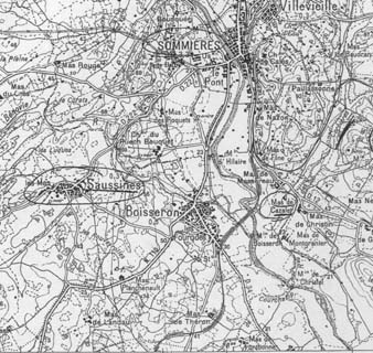
Cazaly ~ Map of part of France
![]()
![]()
![]()
Cazaly ~ Map of part of
France
Ch. du Puech Bouquet
is roughly in the centre of the picture, in the neighbourhood of
Sommieres.
This lies approximately between Nimes and Montpellier.
There is a
further map at the link
http://perso.wanadoo.fr/sylvain.chardon/locom/loc_dep.htm
This is a searchable 18th
Century map of the Kingdom of France named Carte Cassini.
Look for Department 30, Gard.
![]()
![]()
![]()
Last modified 27
Dec 2009